May 3, 2012

First signs of losing land

The wall around al-Walaja, which will extend to cut off Cremisan.
As the plan to build the separation wall continues, more and more signs of this process are ravaging the lands of Cremisan and the Makhrour valley, just outside of Bethlehem and Beit Jala. Demolitions, uprooting of olive trees, and wall construction are increasing at a rapid pace, as these plans become increasingly a reality, and Bethlehem faces losing its last green space. Wall construction in this area has been going on for at least a year, and in the last month al-Makhrour valley is under threat.

The wall is ever-expanding around the village of al-Walaja, discreetly built behind trees, so that the residents in the neighborhood in Gilo cannot see what is happening on the other side.  Between the Cremisan monastery and the Salesian Sisters of Cremisan school, barbed wire is being set up, marking the line of the wall, that will soon cut off the Salesian Sisters from the monks at Cremisan winery.
(See this post for more pictures).

Map c/o BBC
Not only will the wall cut Bethlehem from a monastery that has been part of their Christian heritage and the wine that they frequently buy, it will also cut of Bethlehem and Beit Jala's last green space.  As part of the planned wall expansion, the Makhrour valley, another green area enjoyed by Bethlehem residents and home to 57 Christian families agricultural land, will also be cut off.

On April 3, the first signs of al-Makrours fate were seen.  The Israeli military came into Makhrour and quickly demolished a residential structure as well as the electricity grid erected by the Bethlehem municipality.  (A video and article about the incident).

Today, the al-Makhrour restaurant, built by a family whose home had been demolished by the Israeli military in this area, was completely demolished.


The Israeli military claims that these structures were built without permits.  But in Area C, the area under full Israeli control, permits are nearly impossible to get.

Demolition of al-Makhrour restaurant. Photo c/o http://yfrog.com/ob9a4uhtj.
The Israeli military spokesman claims that the planned construction for the wall is primarily for security reasons, saying: "The rout of the security barrier is based on the specific security considerations of the area. In the Beit Jala region, it is there solely to keep terror out of Jerusalem." (See BBC's recent article).

He noted the violence occurring between Beit Jala and Gilo 10 years ago, during the 2nd Intifada.  With no acts of violence occurring, however, in the past 10 years, and with the separation barriers deep cutting into the West Bank behind the green line, security concerns are highly questionable.

I, myself, spend my weekends walking and picnicking in Cremisan and Makhrour, and ask the question: Is security a justifiable reason to cut people off from their agricultural lands, schools, monasteries, and a place of respite?

April 17, 2012

Natural Springs...Then why don't we have enough water?

 In an effort to enjoy the lovely Spring weather in Palestine and also to explore the natural areas surrounding Bethlehem, my fiance and I have gone on several hikes in the past month or two.  One of the delightful surprises for me on these trips was the discovery of natural springs in the villages surrounding Bethlehem. These trips, however, also carried with them the realization of the intricacies of the injustices of the Israeli occupation of the West Bank, especially in the issue of water collection and distribution.

 After hiking through Wadi (Valley) Makhrour, we ended our hike in the village of Battir.  At the center of this village is a natural spring. After a long hike, we were able to fill our bottles and enjoy the fresh taste of natural spring water.  
On another hike, we stopped in the middle for a rest near a natural spring just down the hill from the village of al-Walaja.  This spring flows from a waterfall and eventually fills a pool with its clear, pure water. 
On the one hand, we enjoyed these natural wonders, while on the other hand being confronted with the injustices of Israeli occupation.  Although Battir's spring is overflowing, Palestinians are not allowed to build any structures in order to collect this water.  Instead, the must allow it to flow to the valley, to aquifers, from which the Israeli authorities will collect this water, and then sell it back to Palestinians for expensive prices.  The same goes for the spring that lies just outside the village of al-Walaja.  Near this spring, two water pumps are found, which pump the water from the spring.  The towers of Mekorot, the Israeli water company, which collects this water and subsequently sells it to both Israelis and Palestinians, can be seen from this hike in the nearby settlement of Gilo.
Battir's spring is overflowing with water after this year's abundant amount of rain.
The Oslo Agreements left several "core issues" to be settled in any final status agreements.  These issues include Jerusalem, security, refugees, borders, water and settlements; issues that have yet to be settled to this day.  In an attempt to address the issue of water, the Oslo Agreements set up the Joint Water Committee (JWC) within which Palestinians and Israelis were to work together on the issue of water.  Not only does the JWC give Israel veto power to any plans to build structures to collect water, the JWC has not been effective in managing water resources.  Until the Second Intifada, the JWC met frequently, up to 10 times per year.  According to a 2009 World Bank report, since 2002 the frequency with which the JWC met dropped to up to 3 times per year, with only one meeting in 2008.  Clearly, with the lack of meetings of the JWC in the past 10 years, Israelis and Palestinians are not effectively cooperating in the distribution of water.

Al-walaja's spring.
As a result of any lack of discussion on the issues of water, the Israeli occupation controls most Palestinian water sources. With the addition of the building of the separation barrier, 194 Palestinian wells and 85 Palestinian springs are cut off from use by Palestinians.  Even the spring in al-Walaja is currently being cut off from this community by the rapidly building of the separation barrier.  Not only will the water be controlled and taken by the Israeli authorities, but this area will not longer be a place for picnics and family outings as we witnessed on the day we were there.

As we walked back up the hill toward al-Walaja, we passed the construction of the Separation Barrier, which will completely cut of al-Walaja from its spring, its farmland, and the neighboring community of Beit Jala.
Moreover, the use of water between Israelis and Palestinians is drastically imbalanced.  The average Israeli uses 4 to 5 times more water than that of the average Palestinian.  A 2011 B'tselem report showed that the use of water in Israeli settlements compared with nearby Palestinian villages was approximately 400 l/c/d (litres/capita/day) to 20 or 80 l/c/d (depending on the village).  In some places, that is 8 to 9 times the use of water.  Furthermore, the Israeli company of Mekorot sells water to settlement farmers at subsidized prices, whereas the average Palestinian household pays between 5% to 40% of their monthly income on water.
"Nicely" leveled land to make way for the path of the separation barrier.

Resources
ARIJ's (The Applied Research Institute - Jerusalem) for The Status of the Environment in the oPt (occupied Palestinian territories), 2011
Assessment of Restrictions on Palestinian Water Sector Development an April 2009 World Bank Report.
Walking Palestine by Stefan Szepesi

April 8, 2012

Easter 2012

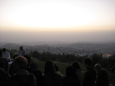
Here are a few snapshots from my vantage point at the Mount of Olives sunrise service for the English speaking Lutheran congregation in Jerusalem.  Unfortunately, my point and shoot camera doesn't capture amazing photos in the dawn light.  This is my 4th year attending this service, and my 3rd year playing for the music...It's nice to make traditions even in a foreign place!


March 27, 2012

Inside Israel

Having lived in Jerusalem and currently living in the Bethlehem area, means that a lot of what I have learned and know about the Palestinian/Israeli conflict is very West Bank and Jerusalem centered.  I know little about what is going on in Gaza, except for what I hear from the news and only snippets from the situation of Palestinians in Israel.  I easily fall into the mindset that because Palestinians in Israel have citizenship and freedom of movement, their situation must be easier.  Two issues have recently come to my attention that have checked this mindset and reminded me that the Palestinian/Israeli conflict is multi-dimensional.  Although the situations in Gaza, Jerusalem, the West Bank, and inside Israel are all different, they are all part of the varying dynamics of this conflict.

Bedouins in Israel and Israel's "unrecognized" villages
Last year, the Prime Minister of Israel's office as been promoting a plan to relocate about 30,000 Bedouin to recognized Bedouin villages in the Negev in Southern Israel.  Haaretz recently reported that about 190,000 Bedouin live in the Negev Desert: 120,000 of these in recognized villages and 71,000 in localities not recognized by the state of Israel. This plan is said to help those Bedouin who live in unrecognized communities, which are thus not provided with any infrastructure by Israel, a fact which has led to an increase in environmental problems in these areas.
Photo c/o haaretz.com

Last week, a UN committee called upon the Prime Minister to revoke this plan.  Instead of recognizing Bedouin localities wherever possible, the plan calls for land exchanges, compensations, and payments, which could cost up to 6.8 Billion shekels (about 1.8 Billion dollars).

Haaretz mentioned that the report " expressed concern ' about the current situation of Bedouin communities, particularly with regard to the policy of demolitions, notably of homes and other structures, and the increasing difficulties faced by members of these communities in gaining access on a basis of equality with Jewish inhabitants to land, housing, education, employment and public health."

In a recent conversation with a friend, she was describing her experience traveling to some Bedouin communities in the Negev. She likened the situation in the Negev to the situation in the West Bank. The West Bank is currently divided into areas A, B, and C.  Area A is under complete Palestinian civil and military control,  Area B is Palestinian civil, but Israeli military control, and Area C is under complete Israeli control.  In the Negev, there are recognized Bedouin villages, (similar to Area A), unrecognized villages where Bedouin live (similar to Area B), and even Jewish only cities (similar to settlements in Area C). These detailed laws which are legalizing racism in Israel, are new details for me and something that I would like to travel for myself and see in the future.

The Citizenship and Entry into Israel Law
Photo c/o haaretz.com
Another issue that has come into the news lately, which has embellished what I know about Palestinians in Israel is the recent passing of the Citizenship and Entry into Israel Law. This law prohibits Palestinians who marry Israeli citizens from obtaining Israeli citizenship.  At times these spouses even have a hard time gaining residency permits.  They are not allowed to drive within Israel, work within Israel, or receive health care.  I won't say much about this issue, but guide you to a recent movie on this subject, about one man who is fighting against this law, so that all humans can be free to love and marry whom they want.

Separation Diary

Articles about the Bedouin Relocation plan: HERE and HERE.
Another article about the Citizenship and Entry into Israel Law: HERE.